maps-and-tables.neocities.org by Ludomir Filas
Last updated: 2017
This is a collection of alternative history maps. Just for fun!
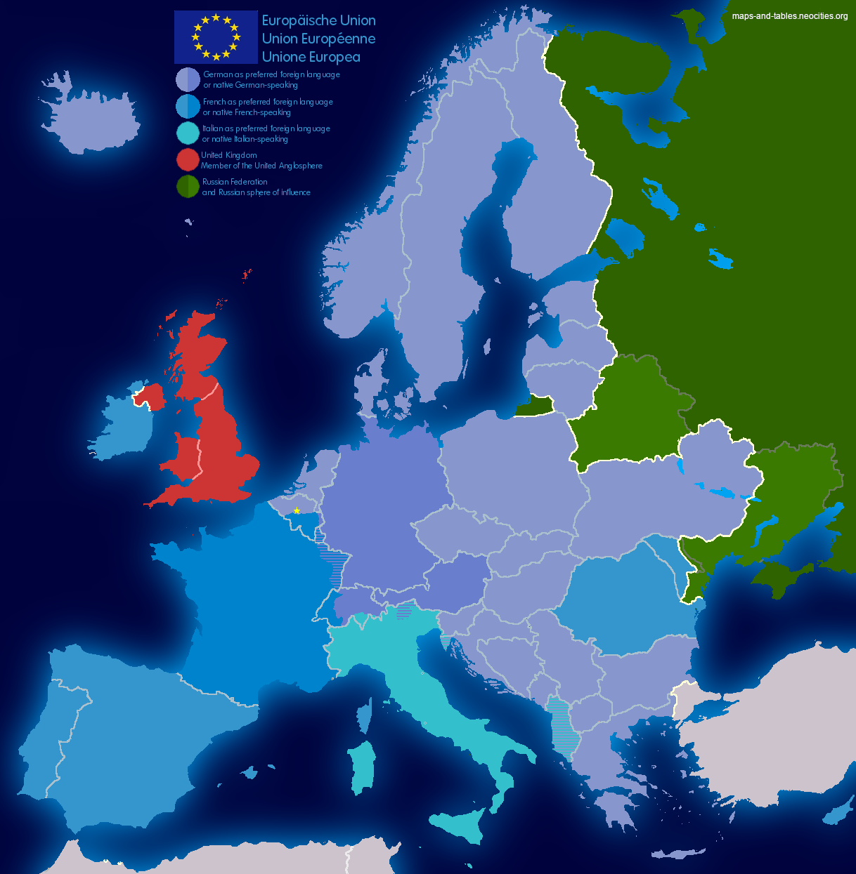
This map entertains the tought of Great Britain leaving the EU and instead getting closer with the other "5 eyes" nations (USA, Canada, Australia, New Zealand). Additionally, there is a continued conflict with Russia, as rump-Ukraine has joined the EU. I also thought about the language situation in the European Union after Britain leaves. This would leave only one English-speaking country in the union: Ireland. And they actually have the near-extinct Irish as their first language, which they try to re-establish as an everyday language. This would leave Europe with three big languages: German, French, and Italian. German and (a bit behind) French are already now the languages with most speakers in the EU, and Italian has about the same number of native speakers as French in Europe (but much less secondary speakers).
Click here to open the picture in a new tab
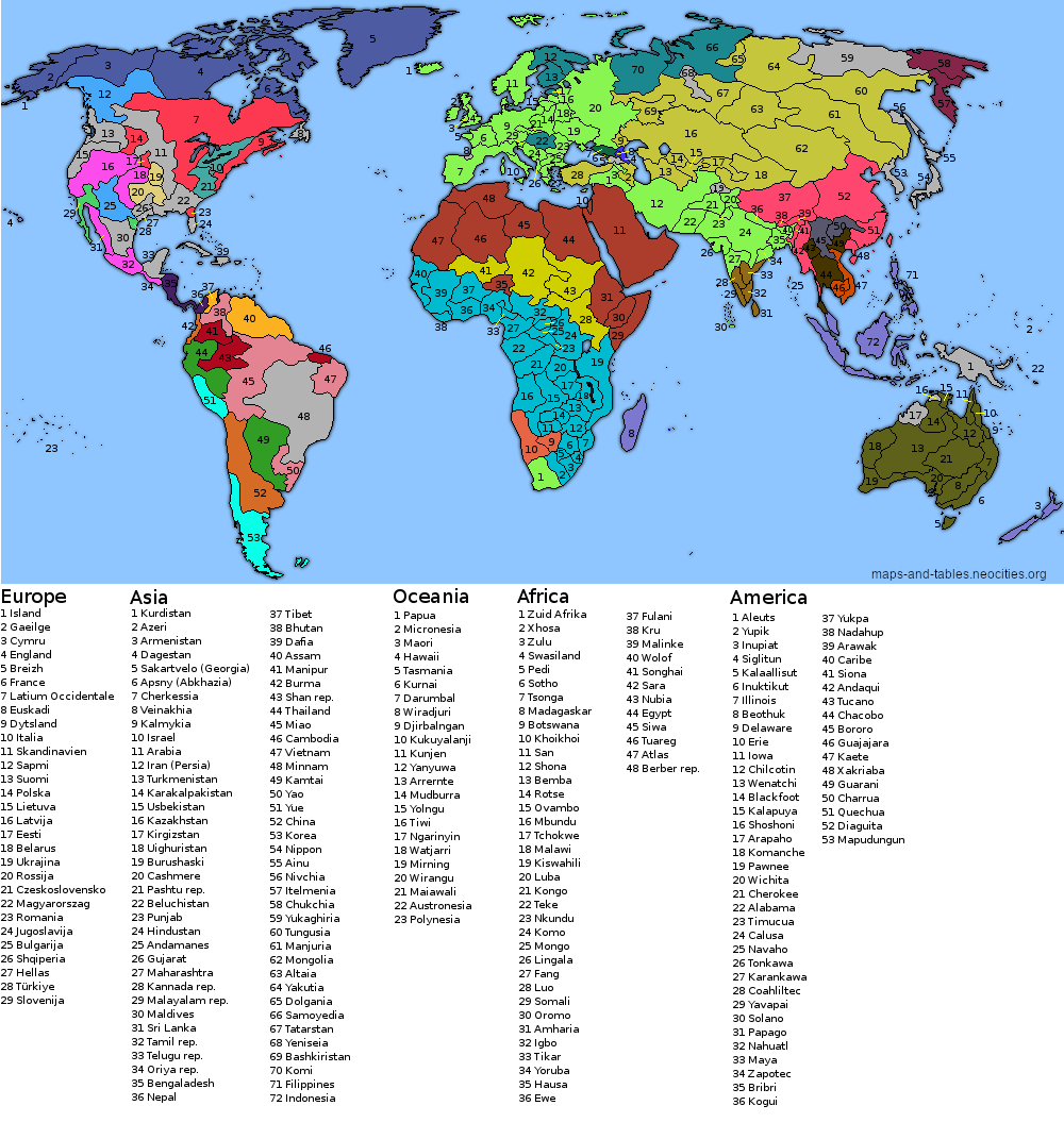
For this map, I tried to only create states based on language borders. As you can see, no colonization of the Americas and Australia/New Zealand is assumed; however, there is also an Afrikaans-speaking state in South Africa and Europe has the ethnic borders from before the world wars. The colours indicate the language families.
Click here to open the picture in a new tab
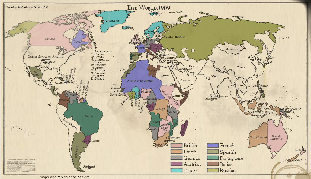
The first map shows an alternative colonialization history, where Austria-Hungary and the fictive Denmark-Sweden also secure some colonies. Additionally, the British Empire and France got some colonies taken away, so that the empires are a bit more balanced.
Click here to open the picture in a new tab
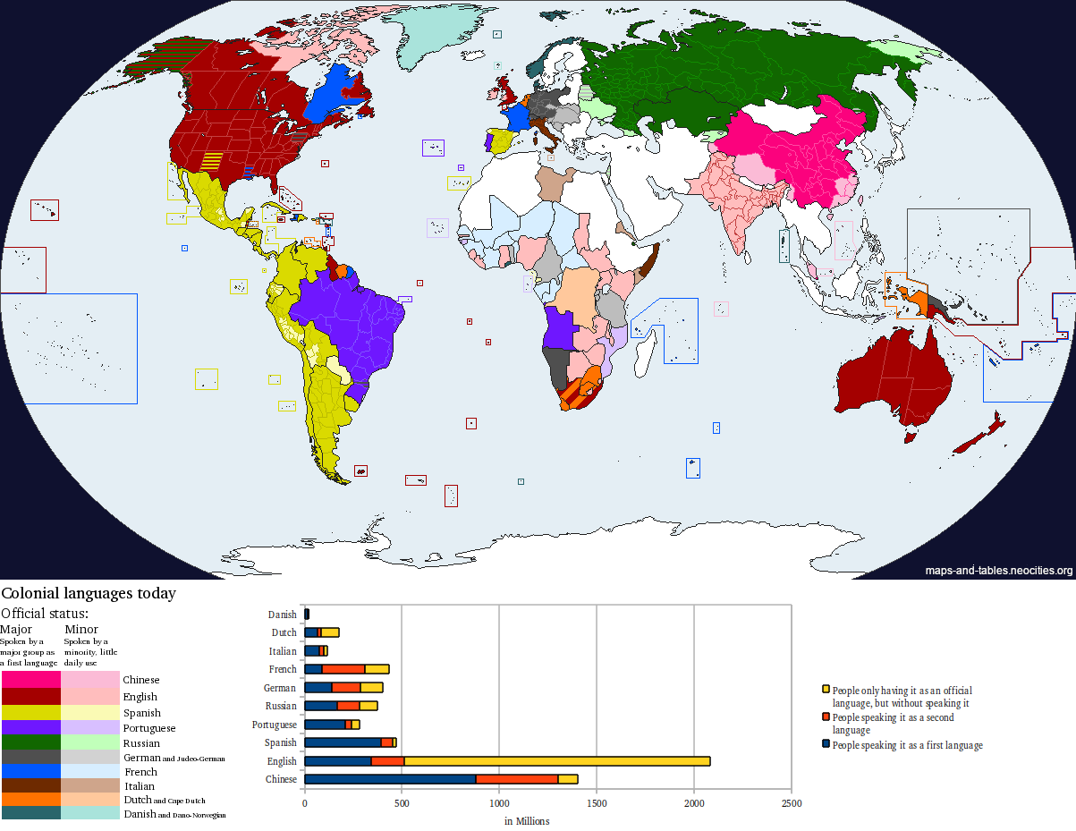
The second map shows a different kind of alternate imperial history and the effect that the colonialization had on the languages spoken in the world today.
Click here to open the picture in a new tab
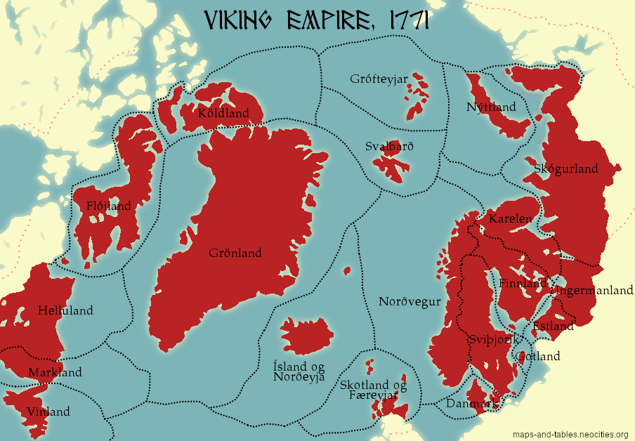
The Viking Empire includes a united Scandinavia (including former possessions of Sweden), former Scandinavian colonies in Greenland and Vinland (America), and also assumes successful settlements in North America and parts of the Russian arctic coast. Most of the lands are quite uninhabitable of course, so this "Empire" could not feed many millions. Nevertheless, it is an impressive landmass on world maps and has a lot of potential for further expansion.
Click here to open the picture in a new tab
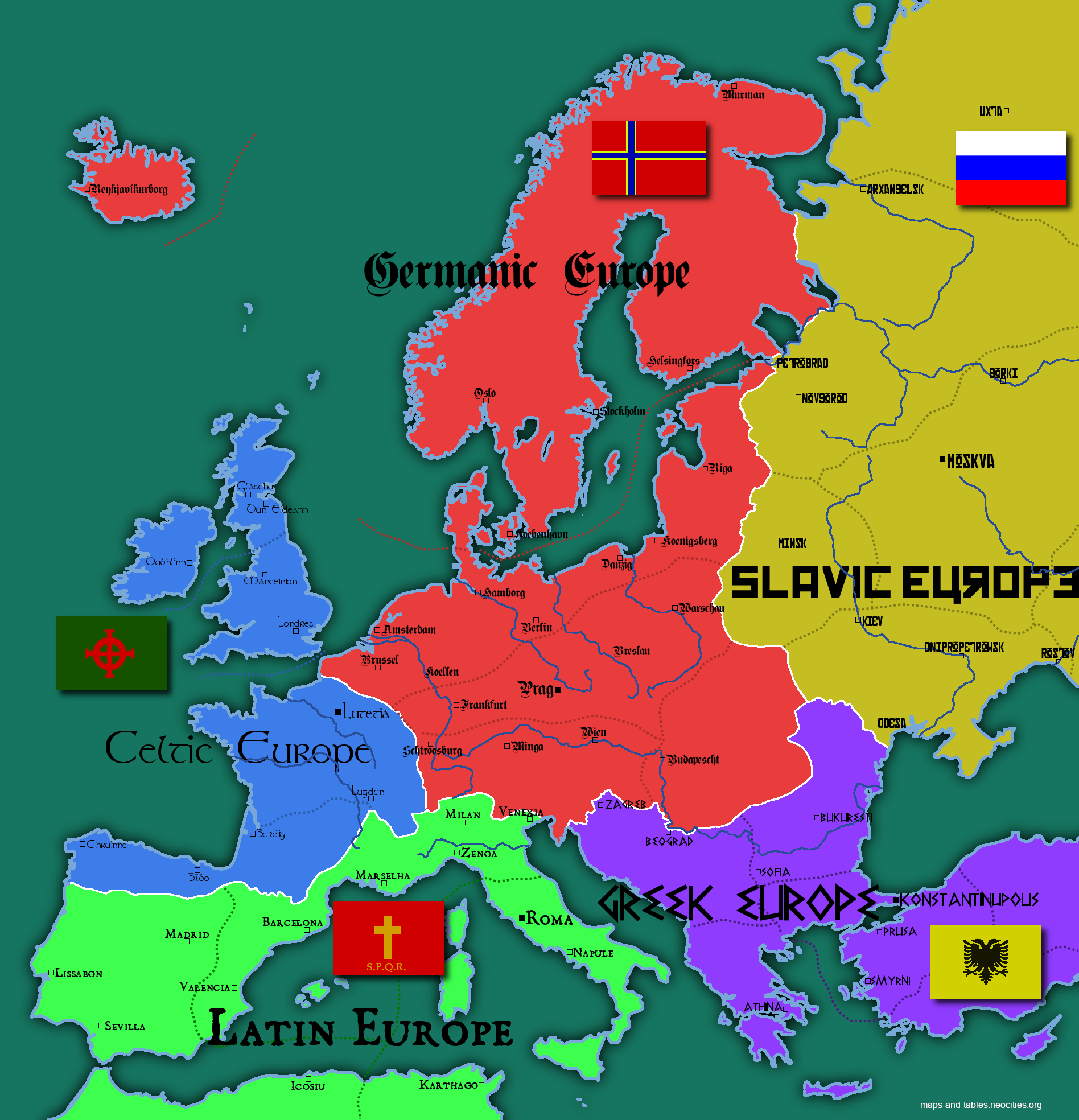
This map shows Europe divided into five cultural zones, which also correspond to the dominant languages spoken there. The dotted lines separate provinces or sub-regions.
Click here to open the picture in a new tab
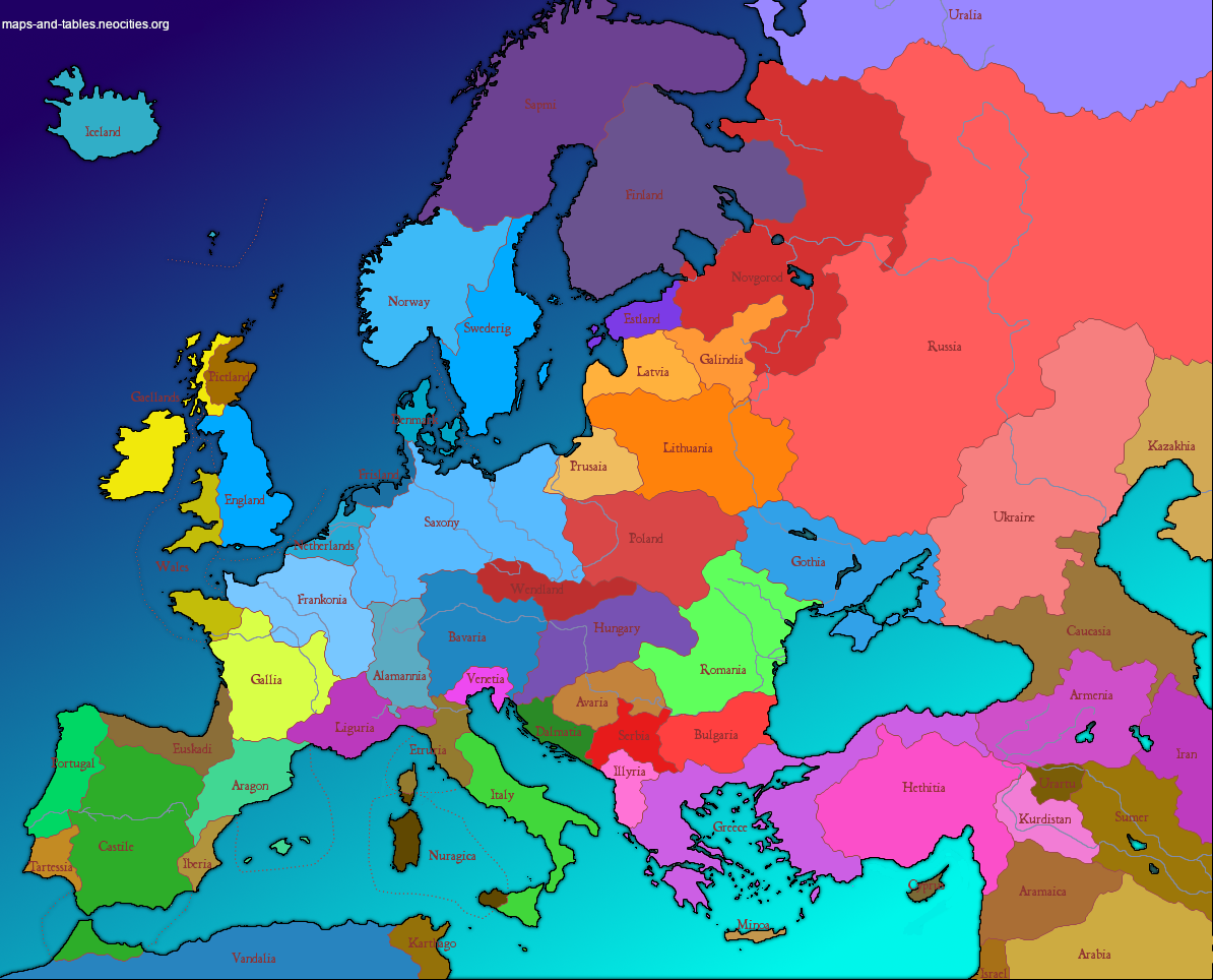
This map shows Europe with some ancient peoples surviving into the present. These include peoples which "recently" disappeared (such as the Crimea Goths or the Baltic Prussians), but also peoples that were replaced centuries ago (such as the Gauls and the Sumerians).
The colours indicate language families:
Click here to open the picture in a new tab
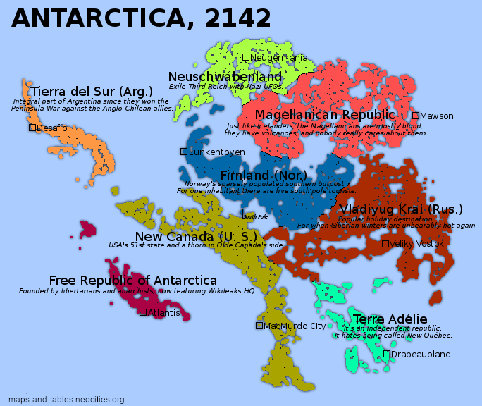
If Antarctica were to unfreeze because of global warming, it would actually not be a massive continent, but a landscape of islands and lakes (the same is true for Greenland). In this map, I have (naively) assumed that all land that is above sea level will become more or less unfrozen clay and all land below sea level will be underwater. This of course would make the continent more attractive to settlement and territorial claims.
Click here to open the picture in a new tab
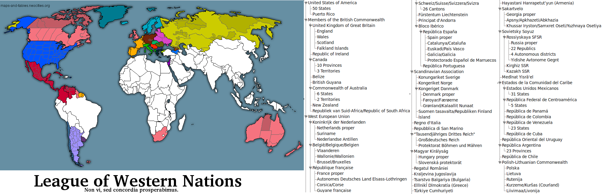
This map shows the "League of Western Nations", which might be compared to somewhat looser European Union. Note that the Third Reich and Israel are best friends, too :)
Click here to open the picture in a new tab
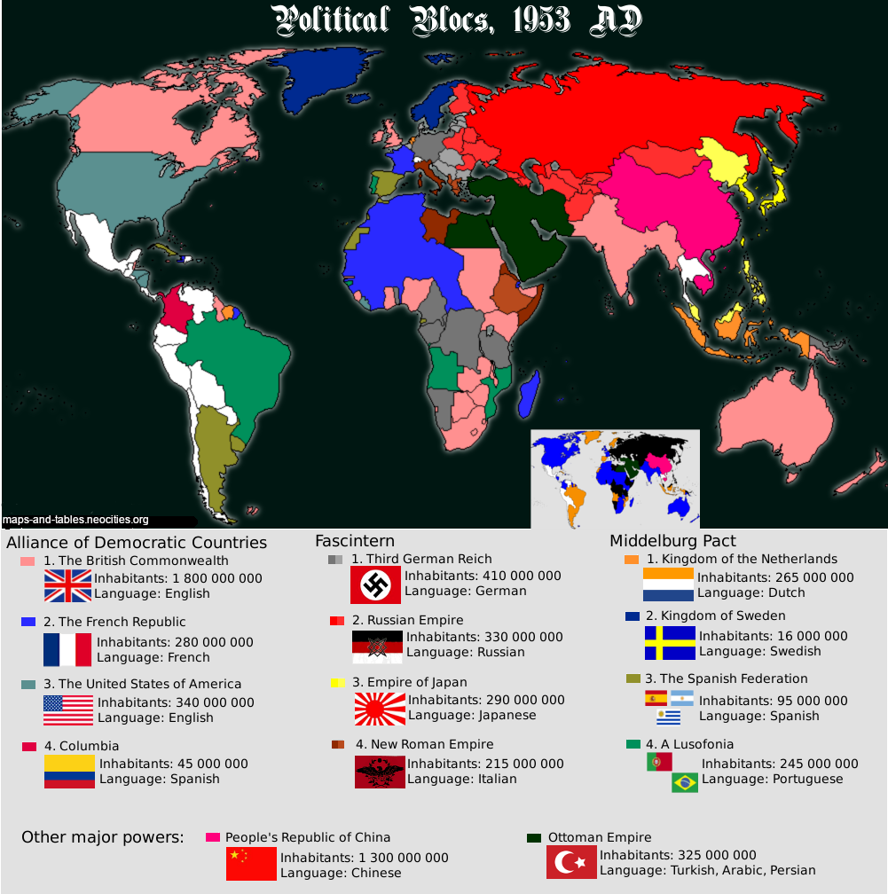
Here we have a cold far consisting of 5 blocs: the liberal bloc led by the USA, the monarchistic bloc consisting of some rather random countries, the fascist bloc (also including fascist Russia), as well as communist China and a still existing Ottoman Empire.
Click here to open the picture in a new tab
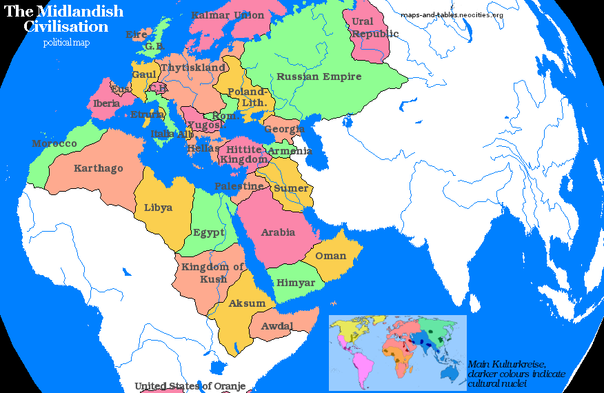
In this map, you should start with the small picture-in-picture. This scenario assumes some larger cultural areas (Europe/Middle East/North Africa; East Asia; Persia/India/Indochina; Sub-Saharan Africa; pre-Columbian North America; pre-Columbian Central & South America). The larger picture then shows the nations that are deemed part of the Midlandish civilization. Again, the map features random states and borders. Sumer and Poland-Lithuania in the same map? Of course.
Click here to open the picture in a new tab
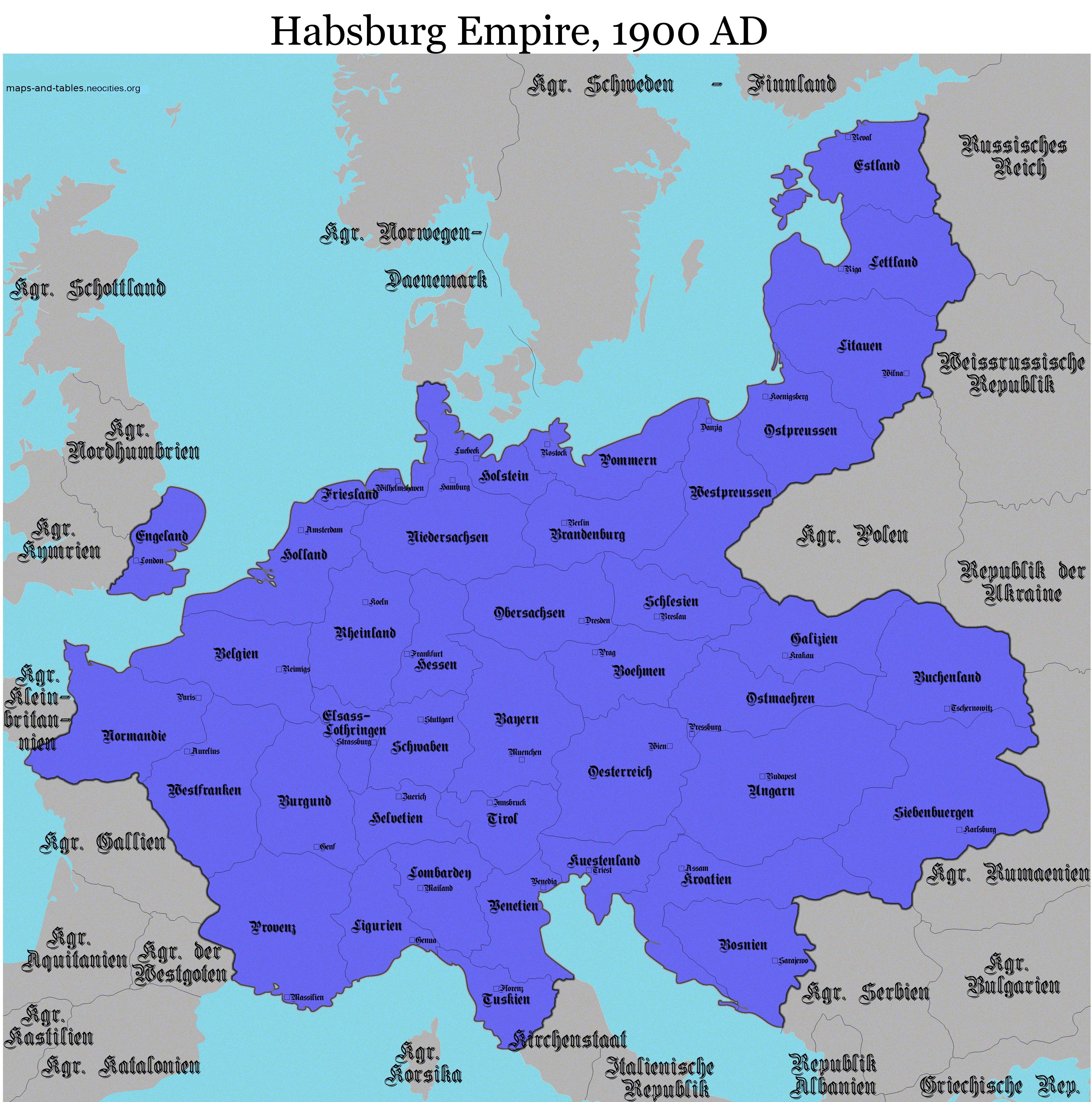
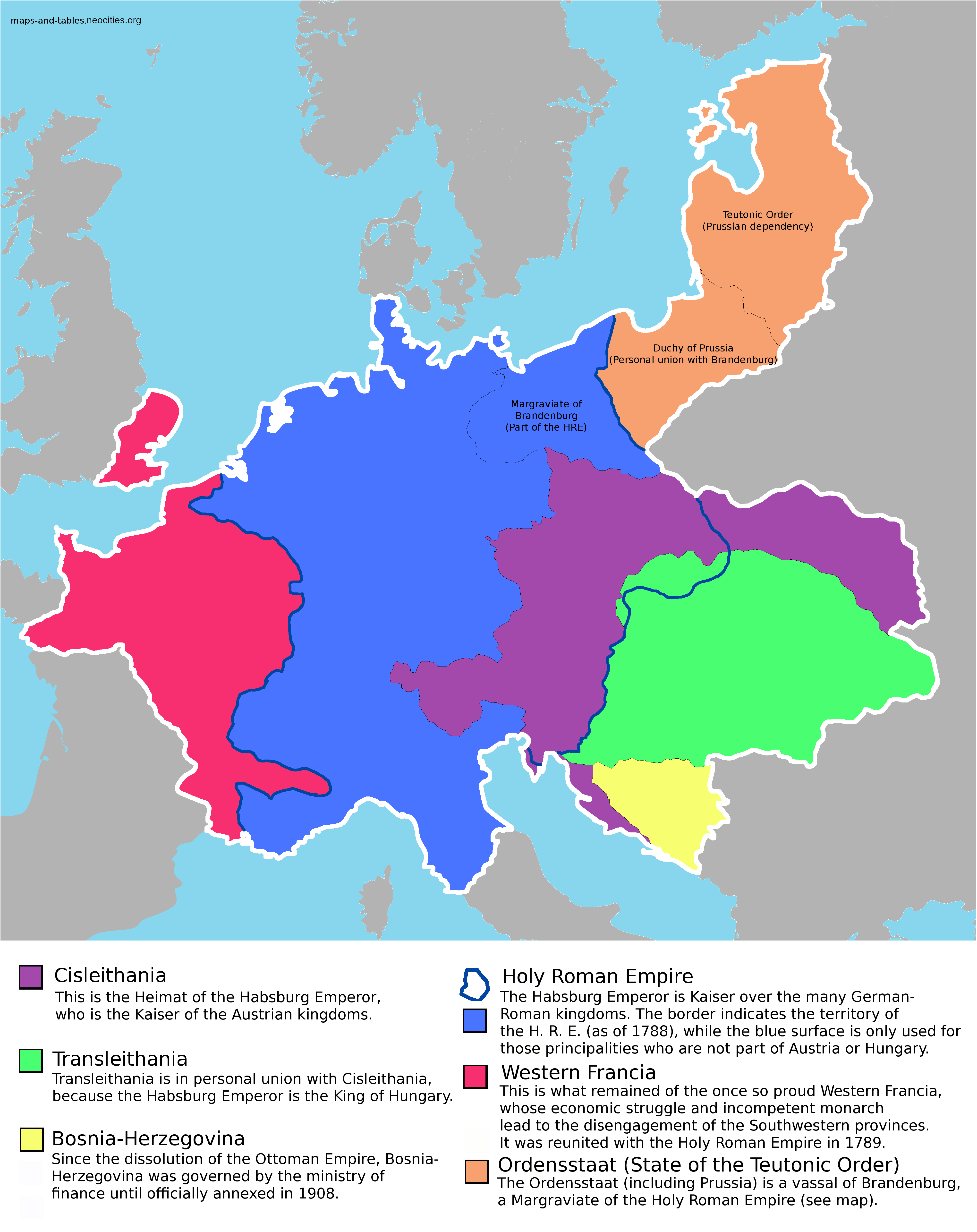
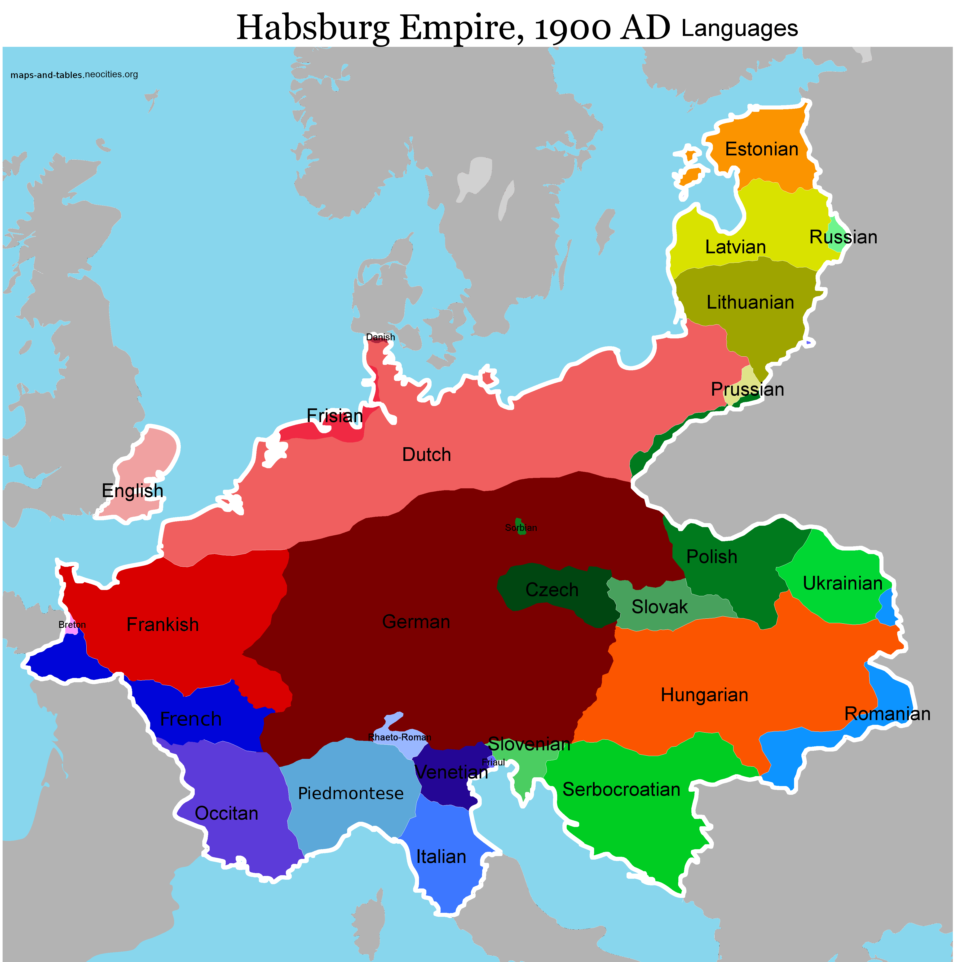
The Habsburg dynasty once ruled Austria-Hungary and the Holy Roman Empire. This scenario assumes a unification of both and also includes dependent Baltic states and parts of Western Francia.The first map shows the administrative division of the Empire and its neighbouring countries, the second shows the history of the unification, and the third shows the languages spoken within the Habsburg realm.
Click here to open the picture in a new tab
Click here to open the picture in a new tab
Click here to open the picture in a new tab
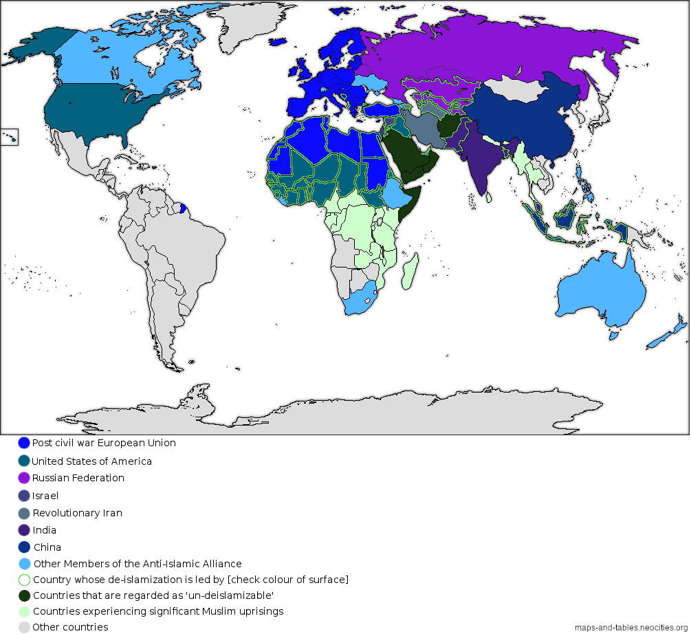
The 21st century is characterized by conflicts with Islam. Muslims vs. Christians (Europe, America, Australia, Russia, Middle East, Africa, Philippines), Muslims vs. Buddhists (Thailand, Indonesia, Myanmar), Muslims vs. Hindus and Sikhs (India), Muslims vs. Atheists (China, Middle East), Muslims vs. Jews (Israel, the West), and of course Muslims against other Muslims (Sunni vs. Shia, Sunni vs. Alawites, Sunni vs. Alevis, radical Sunni vs. moderate Sunni and so on). Imagine a world where all the others team up to fight against Islam, and after a military victory they employ a program of "deislamization", similar to the "denazification" after the second world war. The chance of this happening is about 0%, but I nevertheless entertained the thought. (Please note: I do not assume any genocides in the scenario, I was rather thinking about an re-education program similar to the one against Nazism, which worked pretty well - currently there are only about 5,000 neo-nazis in Germany according to the constitution protection agency).
Click here to open the picture in a new tab
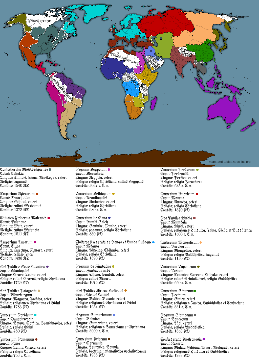
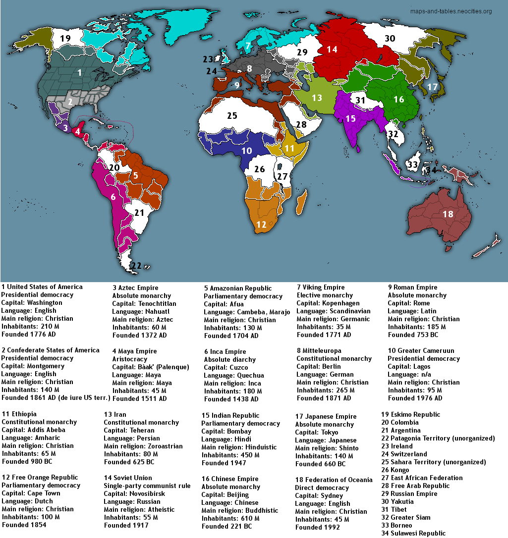
The first map shows a completely random world full of space-filling empires. The legend is written in Latin as the Roman Empire has survived to the present day and is the leading nation in Europe.
Click here to open the picture in a new tab
The next map has the same basic idea as the first one, but features some other empires.
Click here to open the picture in a new tab
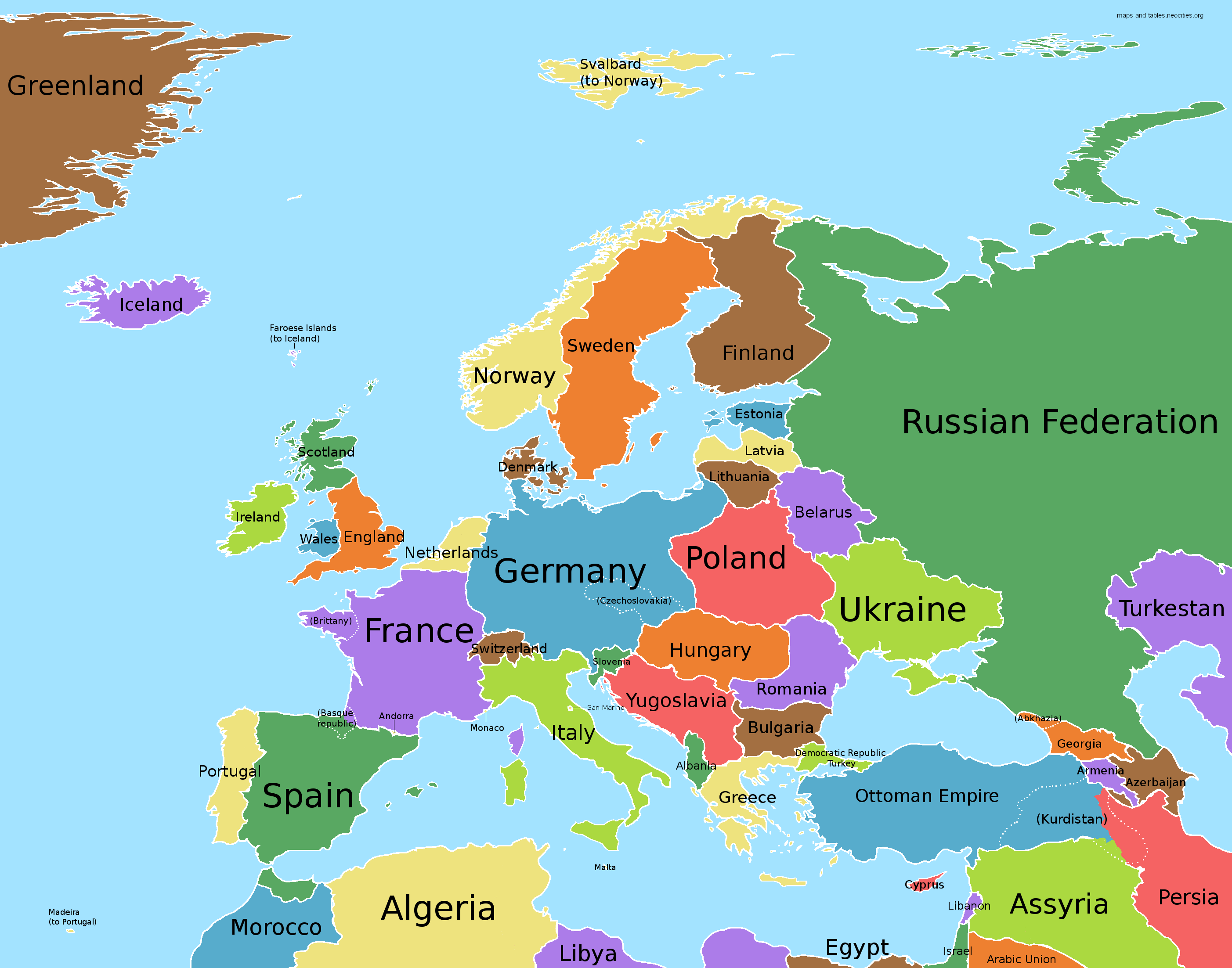
The first map shows some "sensible" alternative borders, based on historic borders or ethnic divisions. The areas indicated by scattered lines can be interpreted as officially autonomous provinces (e.g. Czechoslovakia) or other areas which are de facto self-governed (e.g. Kurdistan).
Click here to open the picture in a new tab
The next map is similar to the previous one in that it shows alternative borders, which are based on historic borders or ethnic lines. Again, Germany is rather large (mixing the pre-WW1 borders and the HRE borders), while some of the smaller nations in West Europe have gained their independency. The three letter acronyms indicate the official and regional/minority languages of each state.

Click here to open the picture in a new tab